


Winds of 120km/h are predicted on Wednesday for the Whitsunday Islands and coastal areas between Townsville and St Lawrence as the cyclone heads toward the coast.
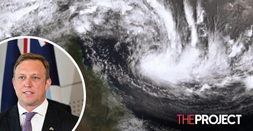
An escalating tropical low over the Coral Sea had been due to become Cyclone Kirrily early on Wednesday morning.
The system was initially predicted to be a category 3 system when it hit the coast between Cardwell and Airlie Beach on Thursday night.
But the Bureau of Meteorology says the system has slowed and could cross the coast as a category 2 between Townsville and Ayr on Thursday night or early on Friday morning.
It is still set to bring destructive winds and "life-threatening" flash flooding.
Damaging wind gusts on offshore reefs and islands have been felt already and they are expected to impact the coast in advance of the system's arrival.
Once Kirrily crosses the coast, Queensland could be impacted by flooding for days.
The system is expected to weaken into a tropical low once more, moving further inland and south.
It is set to bring heavy rainfall to central and southern Queensland from Friday.
With AAP.