


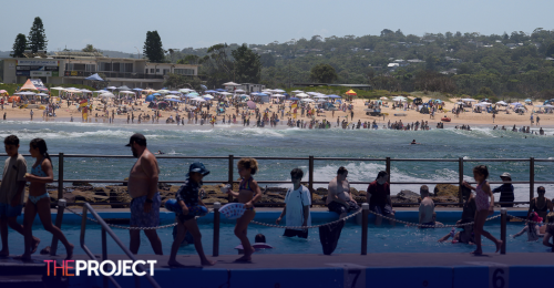
Scorching conditions that swept across Australia during the long weekend moved from South Australia and Victoria to NSW on Tuesday morning. Much of the state—including Sydney—is expecting temperatures in the high 30s or low 40s.
However, a cool change expected in the afternoon will bring the risk of severe thunderstorms, including large hail and damaging winds.
"The majority of incidents were for trees down onto properties and powerlines after strong winds swept through the east of the state … while (Tuesday) is hot, we are anticipating more afternoon thunderstorms with strong winds," a spokesperson said.
NSW Rural Fire Service inspector Ben Shepherd warned of a "vast area of high fire danger", particularly after a staggering 140,000 lightning strikes hit the state in the 24 hours to 7 am.
The Australian Energy Market Operator issued its lowest-tier warning for power supplies in NSW on Tuesday afternoon, encouraging industry participants to lift their output to meet expected demand.
BOM senior meteorologist Miriam Bradbury said a "southerly buster" would bring a sharp drop in temperatures in NSW on Tuesday afternoon and evening.
"A southerly buster is a strong and cool wind which moves up from the south to the north, it is forecast to reach Sydney around 4pm this afternoon, at which time the temperature could drop up to 15 degrees in 15 minutes," she said.
The change should bring strong winds and could also spark potentially severe thunderstorms, mainly around the eastern ranges and out towards the east coast.
On the other side of the country, heatwave conditions are returning. Temperatures across parts of Western Australia are forecast to be 4C to 12C warmer than the typical January averages—and up into the 40s in the next couple of days.
Some towns in the WA's Pilbara, Gascoyne and north interior regions have forecasts of 46C on Tuesday.
Large parts of Queensland, including the northwest, central west, and channel country, are experiencing temperatures in the low-mid 40s.
The NT interior is also set for a sweaty Tuesday, including in Alice Springs, where temperatures are set to reach 43C.
With AAP.